>click2close<
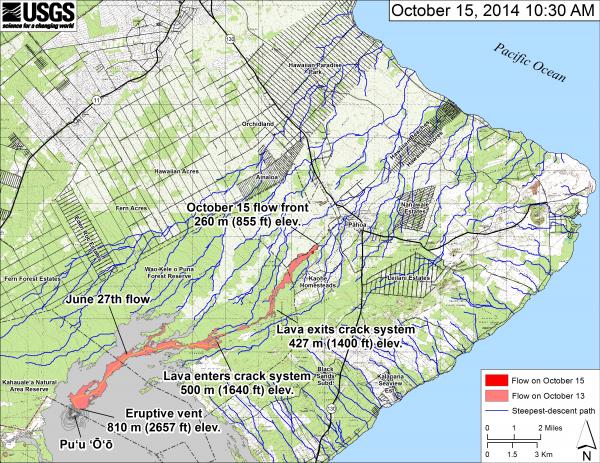
Map of the June 27th lava flow in Kīlauea’s East Rift Zone in relation to lower Puna. The area of the flow on October 13, 2014, at 9:30 AM is shown in pink, while widening and advancement of the flow as mapped on October 15 at 10:30 AM is shown in red (HVO / USGS)